Giant Cave  ·  Caye Caulker, Belize  ·  2015 Expedition

Kilometres of Darkness
Beneath the Island

One of Belize’s most spectacular cave systems winds beneath a densely populated tourist destination — discovered in 1977, explored ever since, and still holding secrets.

Photo © Mark Long  ·  2015  ·  Giant Cave, Caye Caulker, Belize
First Discovered
1977
Paul Heinerth
Max Depth
180 ft
55 metres
Explored Passage
~30,000 ft
Approx. 9 km of surveyed cave
Location
Caye Caulker
Belize, Central America
Chapter Three  ·  The Caves Below

A Labyrinth Beneath
the Living Island

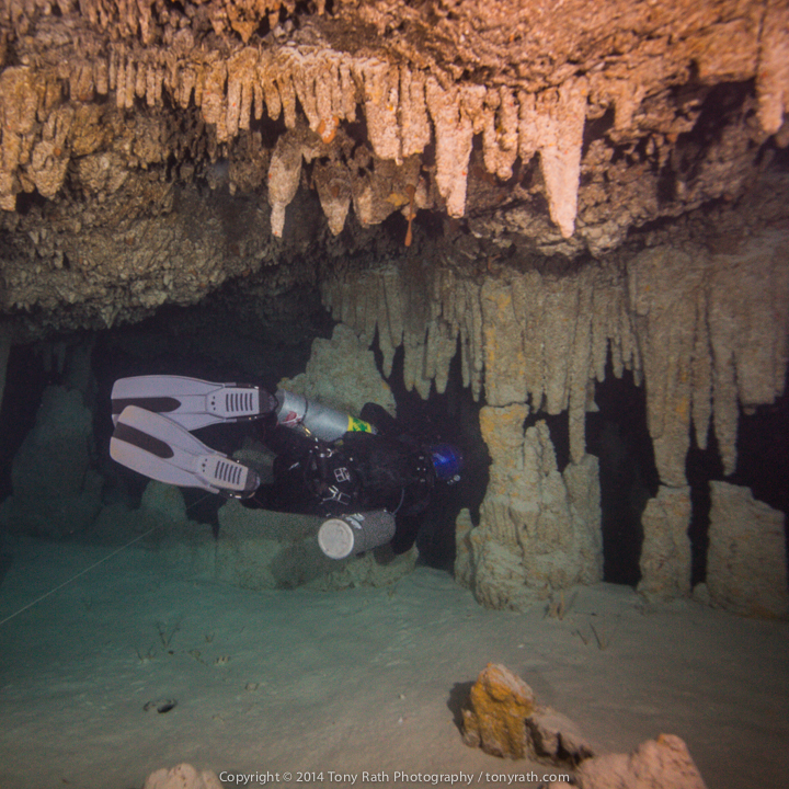
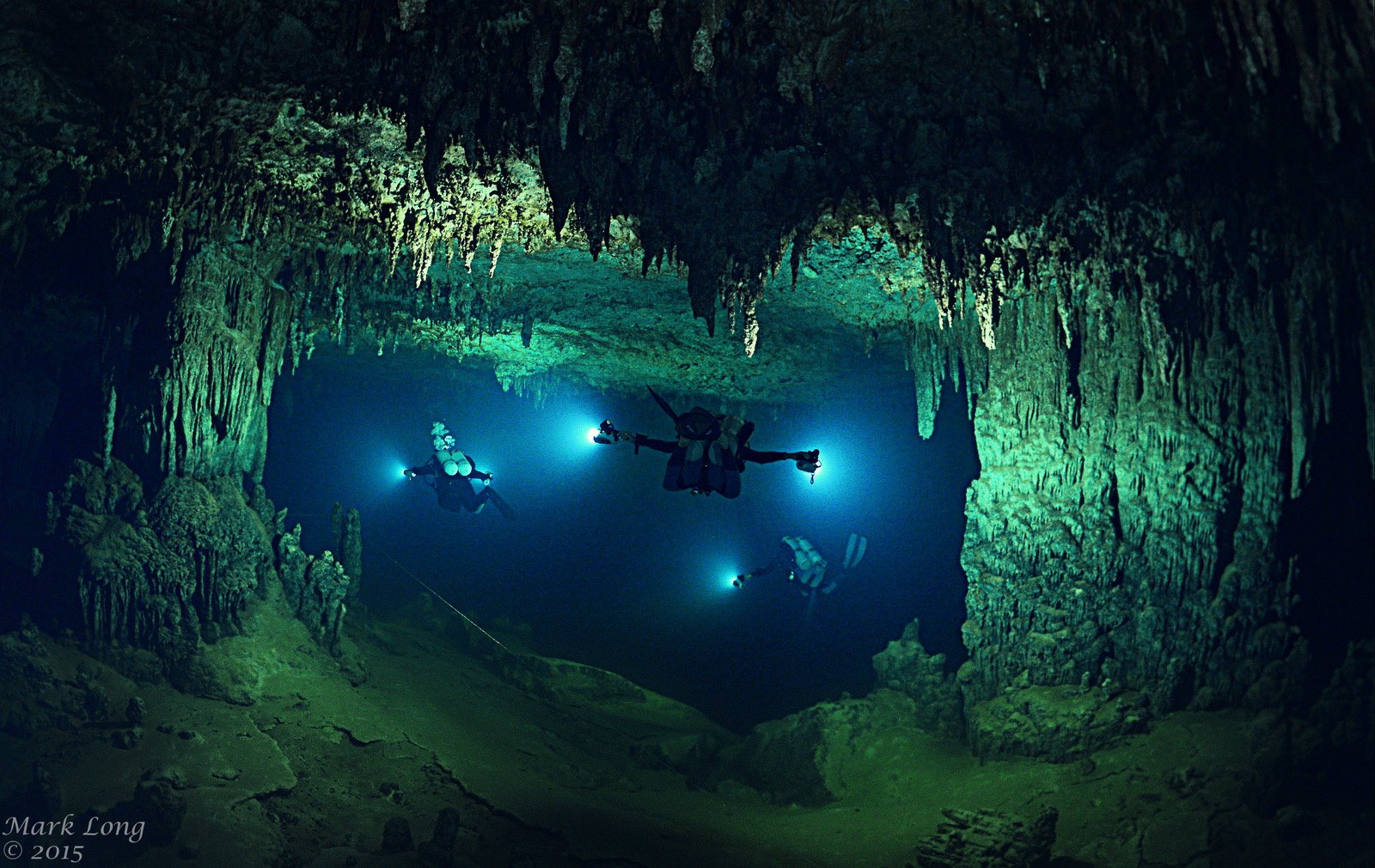
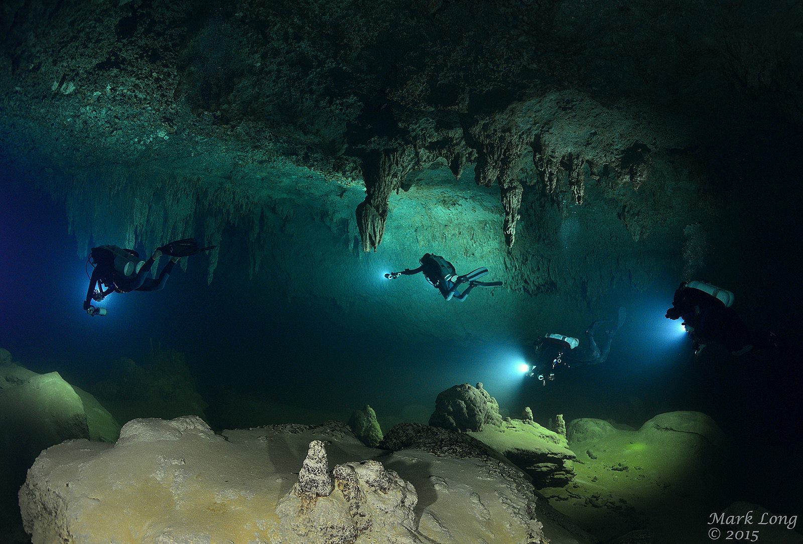
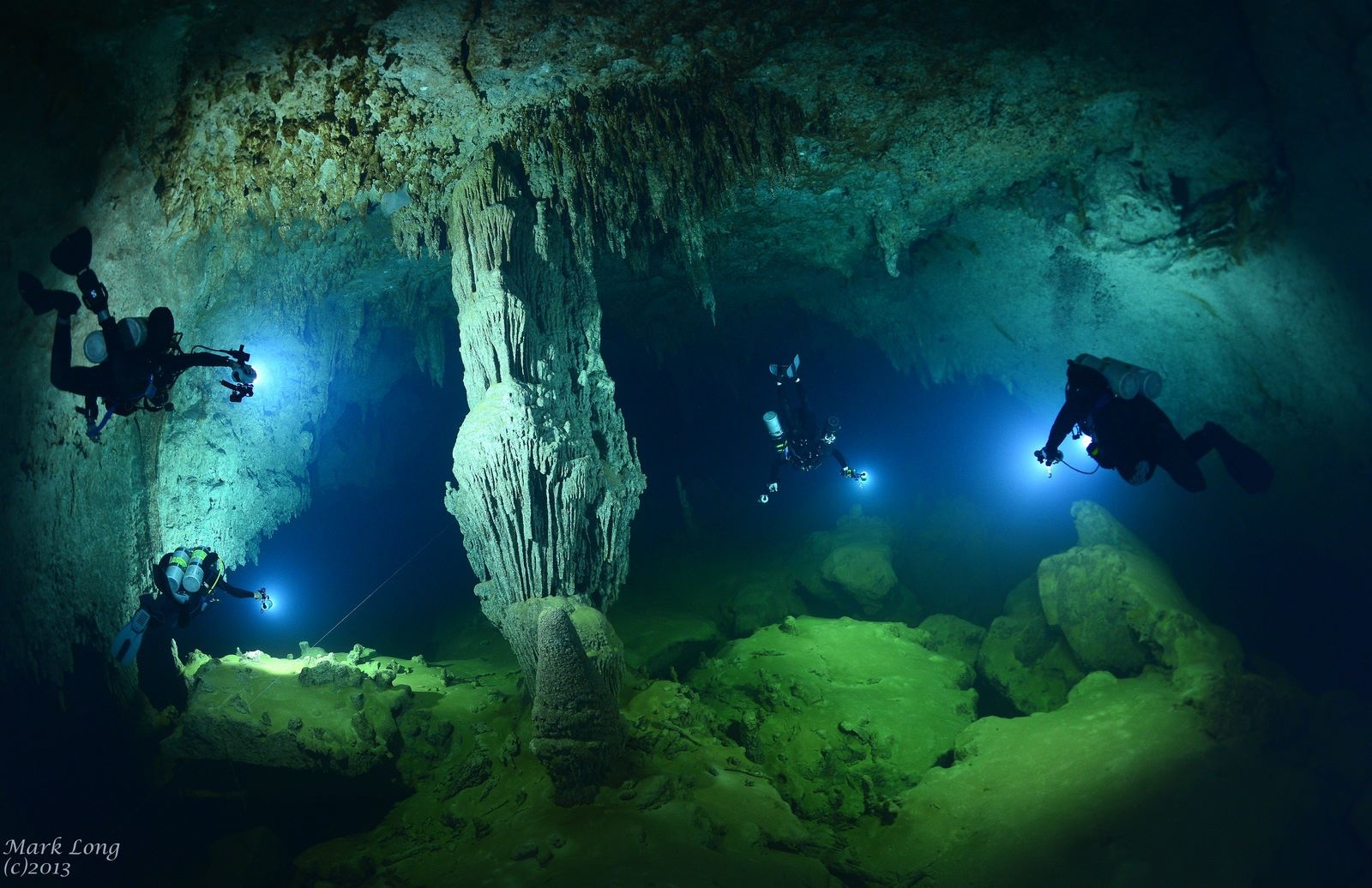
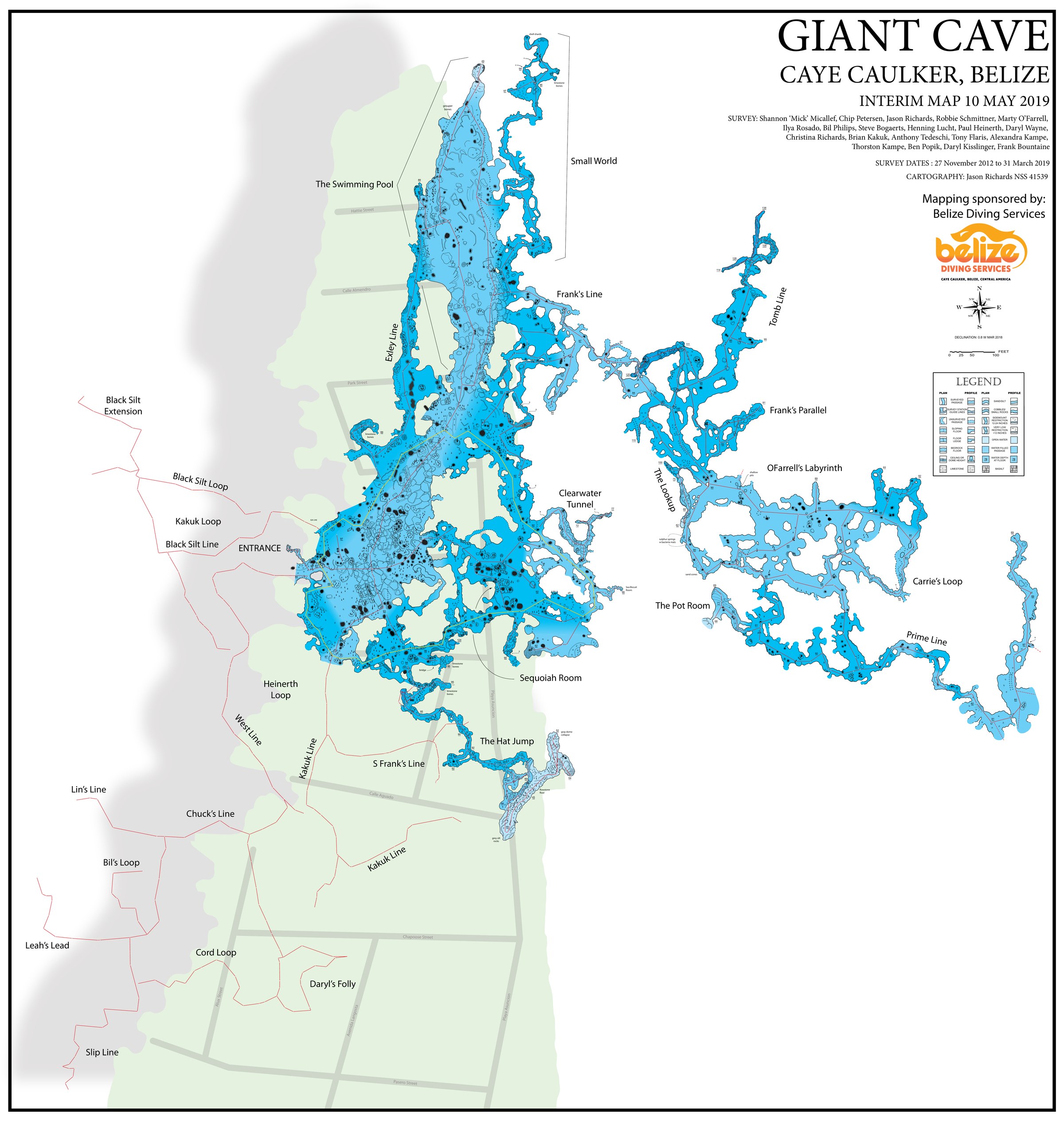
Beneath the sun-drenched streets and sand paths of Caye Caulker — one of Belize’s most popular tourist destinations — lies a world that almost no visitor will ever see. Giant Cave is a kilometres-long cave system of extraordinary beauty, threading through the limestone beneath the island, its passages adorned with stalactites that took millennia to form.

The cave was first discovered in 1977 by Paul Heinerth, who would go on to co-found Belize Diving Services on the island above. In the decades since, explorers have charted roughly 30,000 feet of passage, with maximum depths reaching 180 feet. The system remains one of the most significant cave diving destinations in all of Central America.

Beauty and tragedy exist side by side here. The cave’s allure has drawn divers from around the world — and its unforgiving passages have claimed the lives of those who ventured beyond their training.
⚠  Safety Notice

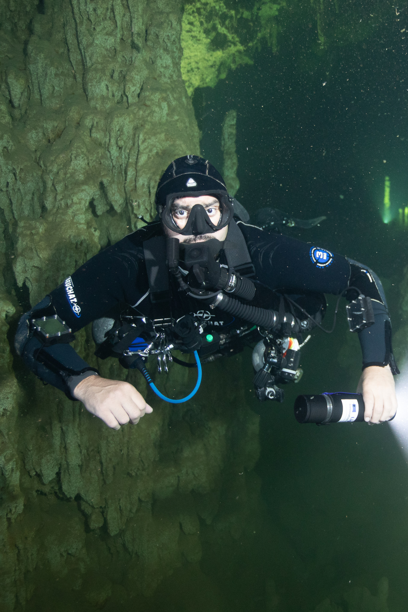
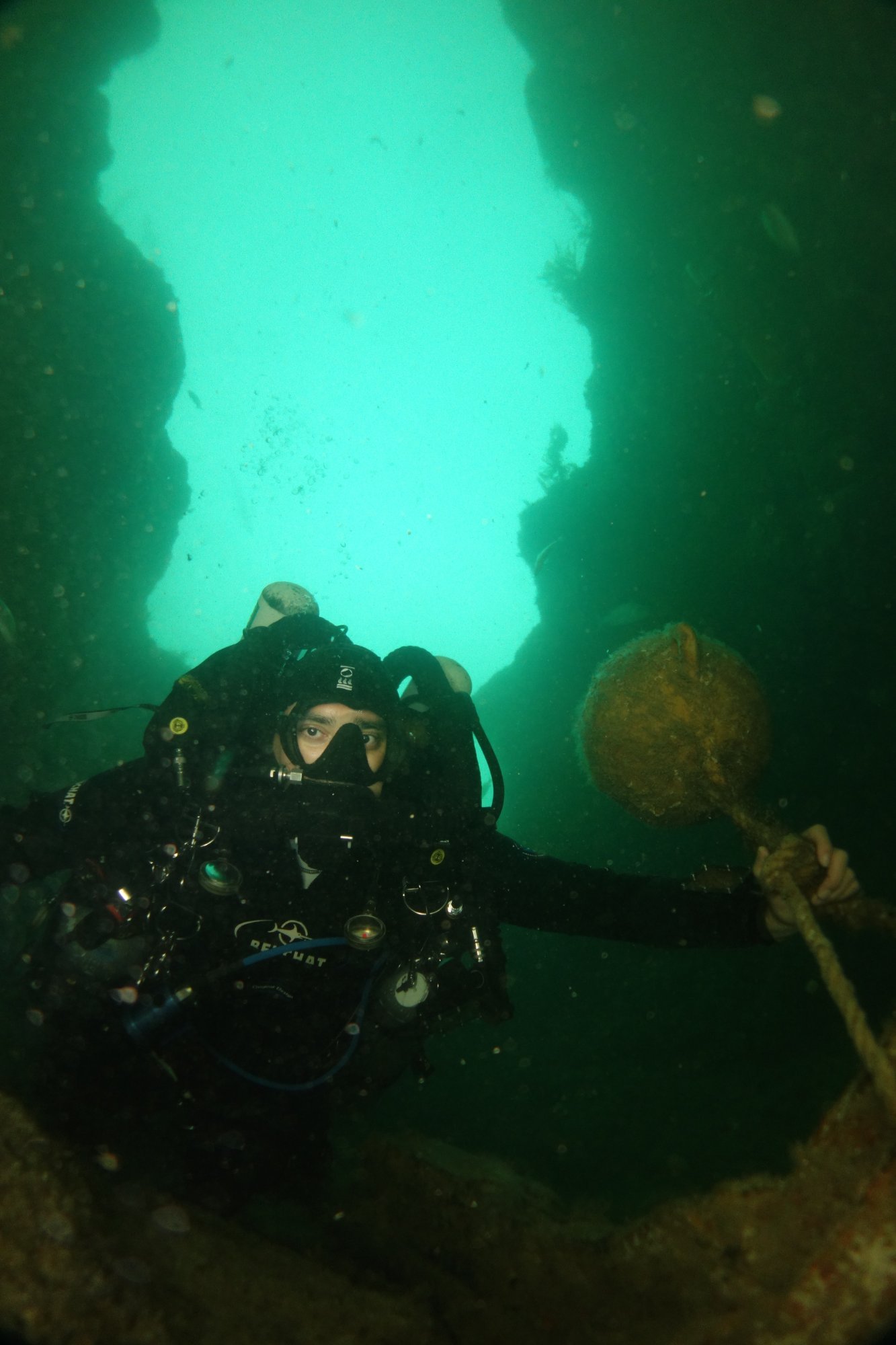
Giant Cave is a technical cave diving environment. It is accessible only to divers holding full cave certification, accompanied by a properly trained guide. The system has taken lives. Cavern and open-water certifications are not sufficient for entry.

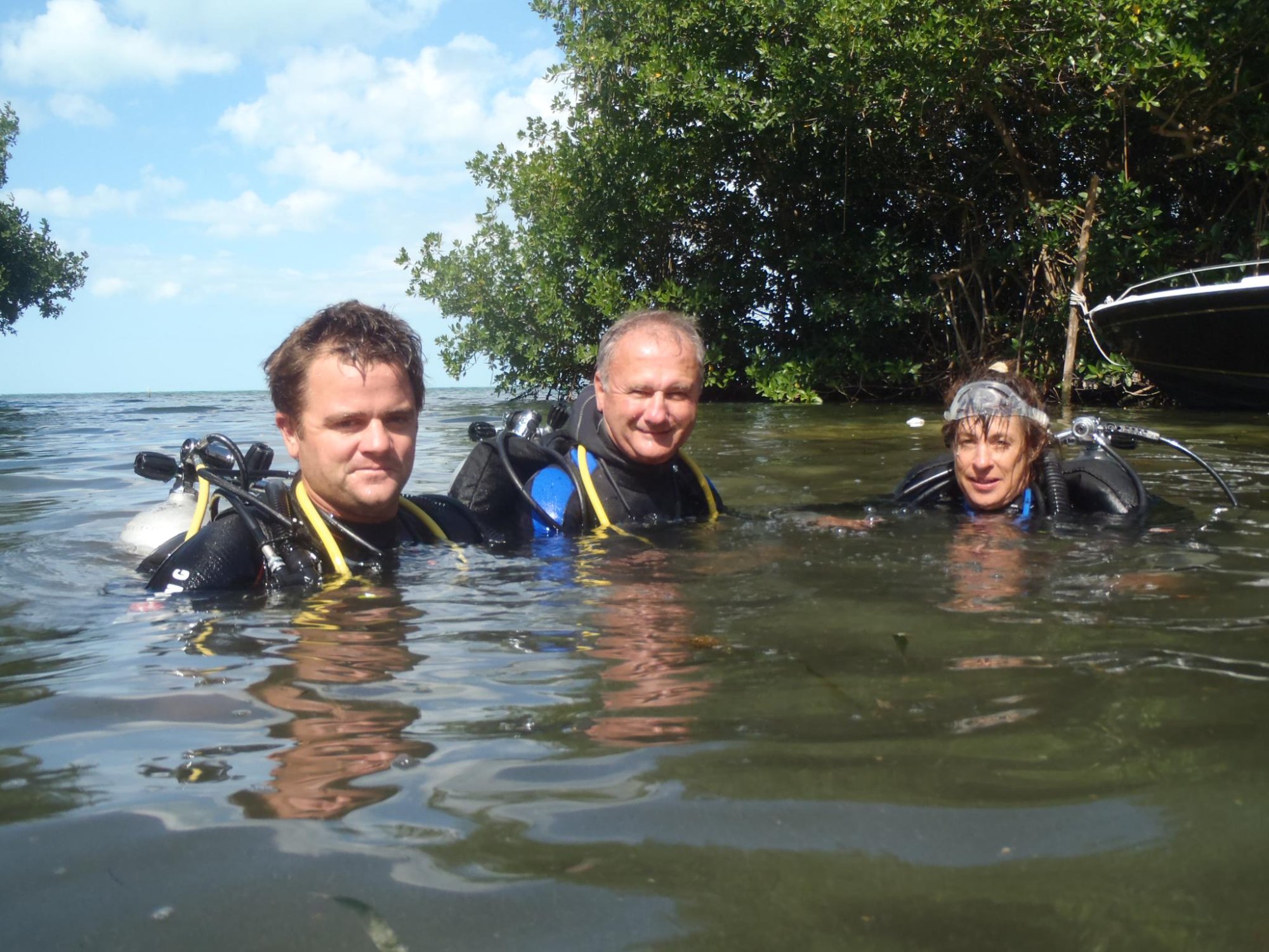
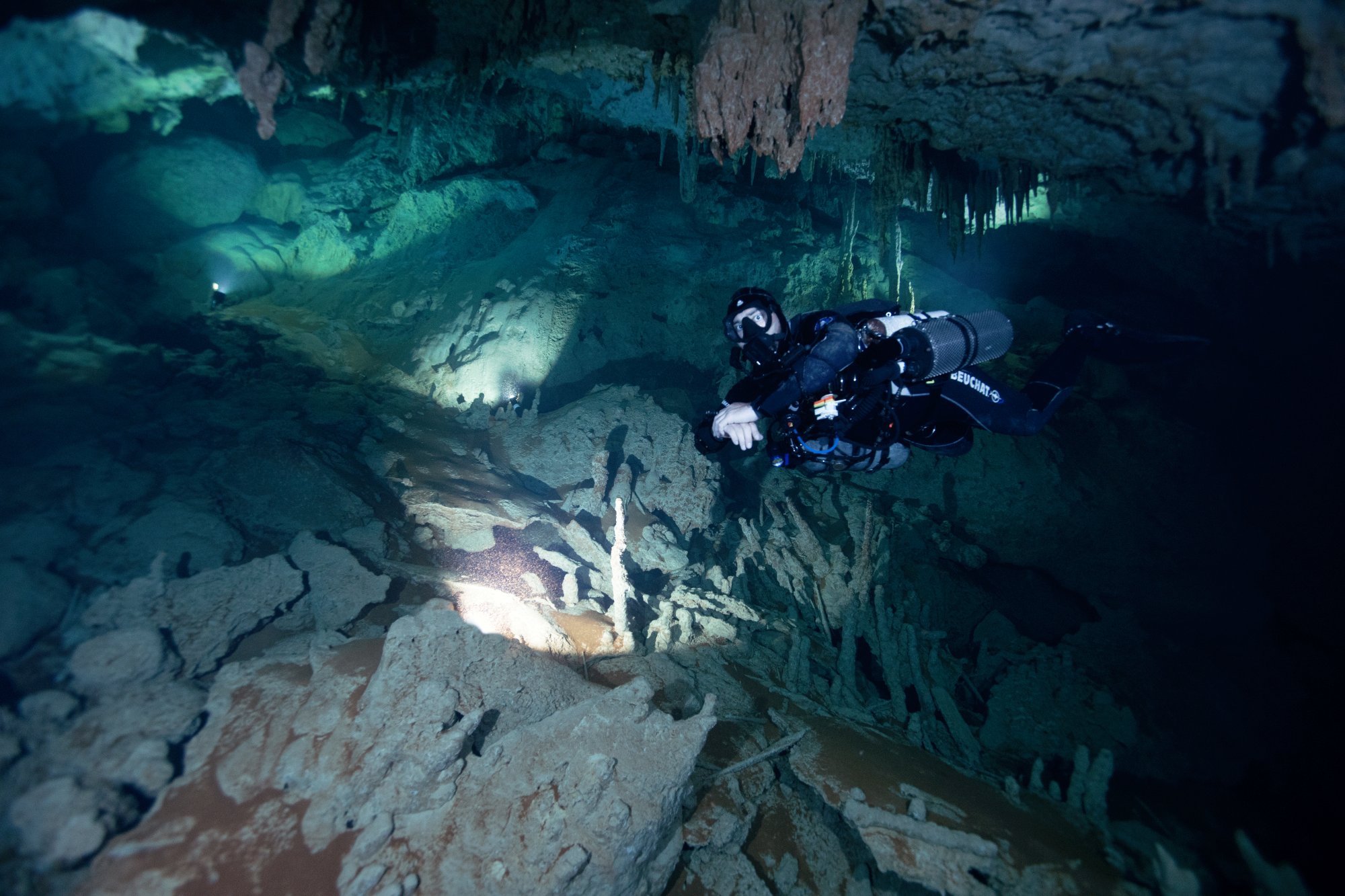
In 2015, Mark Long returned to Giant Cave with a team of experienced cave divers to document its passages photographically. Accompanied by Annette Long, Bird Oestrich, Diane Oestrich, and Chip Petersen, the expedition produced a remarkable visual record of a cave that few people will ever experience firsthand.

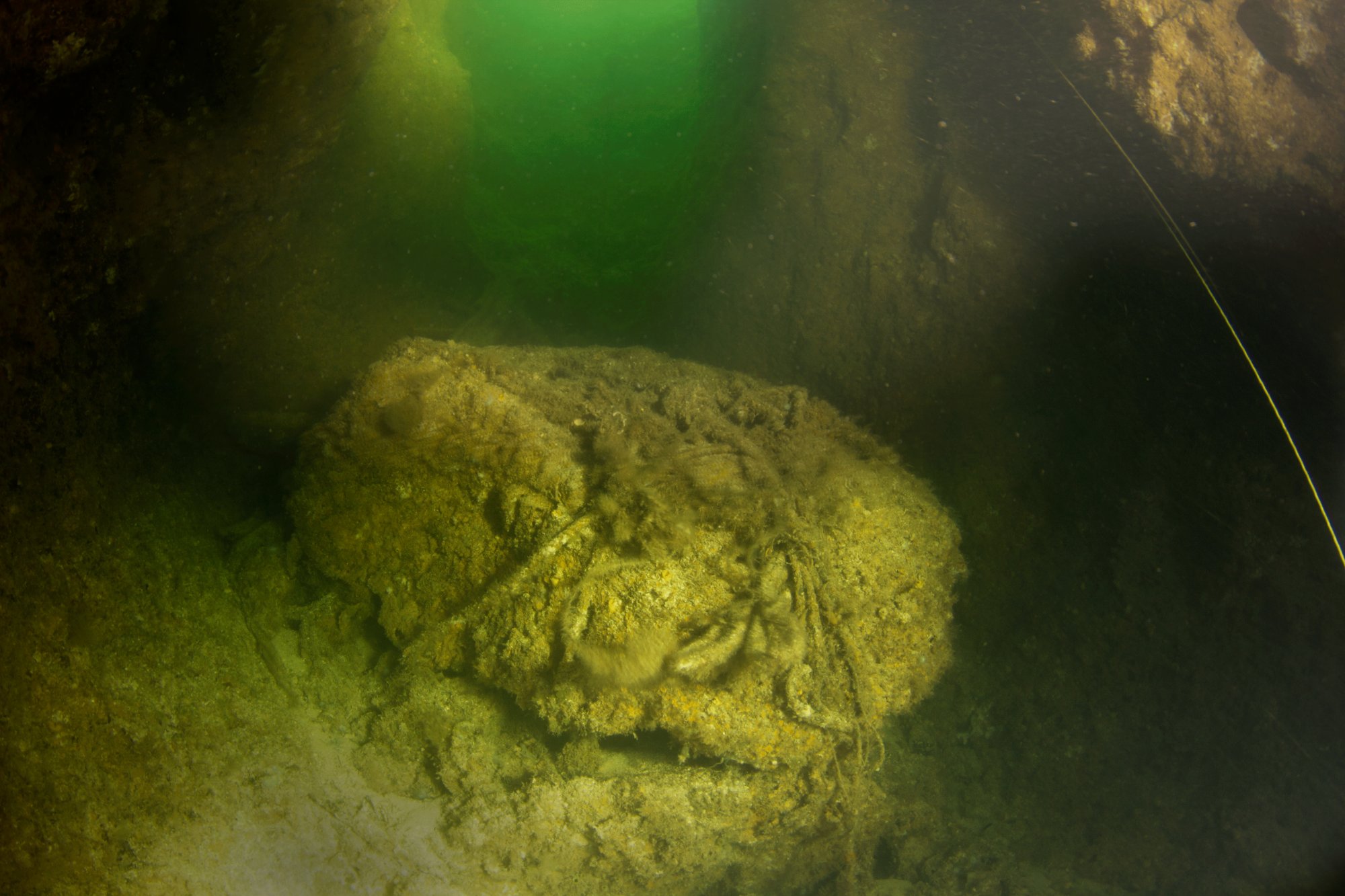
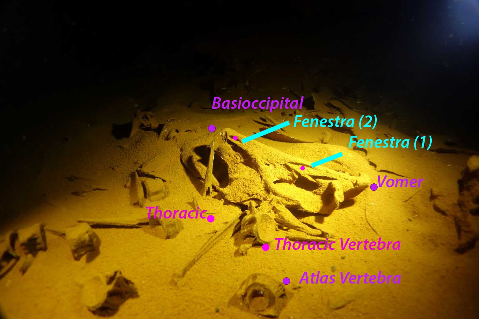
What they found was unchanged by time: vast chambers hung with thousands of stalactites, their dive lights illuminating green-tinged walls and floors of pale limestone silt that had settled undisturbed for centuries. The cave receives no daylight. Sound does not travel the same way. Navigation depends entirely on a guideline and the training to follow it back.

Paul's Boulder — the limestone boulder Paul Heinerth removed from the cave entrance in 1973
Paul’s Boulder  ·  Giant Cave entrance  ·  Photo © James Petersen
The Discovery  ·  1973

The Boulder That
Opened a World

In 1973, Paul Heinerth was diving near Caye Caulker when he noticed something unusual: a strong outward-flowing current emanating from beneath a large limestone boulder on the cave floor. Where there is current, there is passage. He removed the boulder.

After some tense moments of swimming through the restriction, Paul gazed out into a crystal-clear cave adorned with monstrous speleothems — formations rising and hanging in a chamber 150 feet deep. He had found the entrance to what would become one of the most significant cave systems in Central America.

That boulder still rests near the entrance today, a silent monument to the moment of discovery. The current Paul felt that day still flows. The cave beyond is still waiting.

1973 Year of Discovery
150 ft Depth at Entry Chamber
Paul Heinerth First to Enter
The Modern Era  ·  2011

Permission Granted:
Reopening the Cave

For years after a series of tragic deaths, Giant Cave was effectively closed. Without institutional guidance on how to manage the system — or protect the animals that might live within it — access had been restricted and the cave lay largely undocumented beneath the streets of Caye Caulker.

That changed in 2011, when the Belizean Institute of Archaeology granted permission to James “Chip” Petersen and his team to resume exploration. The mandate from director Jaime Awe and supervisor Sylvia Batty was direct: go into the caves, find out what is down there, and bring the findings back so that the Institute had the information it needed to properly manage the system and protect whatever life it harboured.

It was the beginning of a new chapter — one that would lead to the systematic survey coordinated by Jason Richards, the photographs of Mark Long, and the deepest understanding yet of what lies beneath Caye Caulker.

2011 IOA Permission Granted
Chip Petersen Expedition Lead
Jaime Awe & Sylvia Batty Institute of Archaeology
Chip Petersen, Bill Oestrich and Diane Oestrich at the Giant Cave entrance, Caye Caulker
Chip Petersen  ·  Bill Oestrich  ·  Diane Oestrich At the entrance to Giant Cave  ·  Caye Caulker, Belize

“Go find what is in the caves and bring the results back — so that we have the information needed to manage them.”

— Jaime Awe & Sylvia Batty, Institute of Archaeology of Belize, 2011
Exploration  ·  2012 Onwards

“The Line Just
Snapped.”

After the Institute of Archaeology granted access in 2011, the real work began. Chip Petersen and Marty O’Farrell committed to the cave week after week, spending hours on every dive searching for new passage and attending to the maintenance that decades of neglect had made necessary.

The original guide lines — laid by Paul Heinerth and Frank Bountaine in the 1970s and ’80s — had been in the water for thirty years. Encrusted in calcite, they had become brittle and unreliable. On one of their early dives, Chip reached for the line and it simply gave way. “The line just snapped,” he said. He knew then the scale of what they had taken on.

Systematically replacing line, clearing restrictions, and re-surveying passage that had not been visited in a generation, the two divers built the foundation for everything that followed. Their efforts paid off in a way neither had quite anticipated: Marty O’Farrell broke through the end of a known passage into an entirely new region — the vast network now called OFarrell’s Labyrinth — where miles more cave was waiting, untouched and unsurveyed.

The Labyrinth area, visible on the right-hand side of the 2019 survey map, represents some of the most significant new discovery in the cave’s history. It remains only partially explored today.

2012 Active diving resumed
30 Years Lines calcite-encrusted
OFarrell’s Labyrinth Marty’s breakthrough passage
Giant Cave  ·  Caye Caulker, Belize Expedition footage  ·  Belize Diving Services

“It’s some of the hardest cave diving in the world — but then once you get in there, it gets more and more beautiful.”

— Chip Petersen, Belize Diving Services
Richards Expedition  ·  2015–2016  ·  Shannon “Mick” Micallef

Discovery in the
Pot Room

During the Richards’ mapping expedition, Australian cave diver Shannon “Mick” Micallef joined Chip Petersen for sustained exploration. In addition to laying thousands of feet of new guideline and resurveying existing passage, Mick made two findings that changed how the scientific world understands Giant Cave.

01
First Maya Artefact in a Submarine Cave
Cave diver in Giant Cave among stalactites — © 2014 Tony Rath Photography
© 2014 Tony Rath Photography  ·  tonyrath.com

While exploring the passage now known as the Pot Room, Mick discovered what would be confirmed as the first Maya artefact ever found in a submarine cave. The significance was immediate: the cave, which had been considered primarily a geological site, now carried archaeological weight. It placed Giant Cave within the broader story of Maya cave use — a tradition well documented in dry caves across Belize, but never before confirmed in a fully submerged, marine system.

02
Ancient Bones — Older Than Anyone Knew
Annotated photograph of ancient fish skull bones found in Giant Cave, Belize
Skeletal analysis  ·  Giant Cave, Caye Caulker

Bones in the cave had long been assumed to belong to tarpon — a reasonable guess given the large tarpon that congregate near the cave entrance. Mick’s find prompted closer analysis. The bones were identified as belonging to an ancient relative of grouper, a species far older than tarpon in the evolutionary record. The annotated skull — showing the basioccipital, fenestrae, vomer, and vertebrae — places these remains well beyond what had originally been assumed. Their true age makes them a significant palaeontological find.

Shannon 'Mick' Micallef cave diving in Giant Cave wearing a top hat
Mick in the Top Hat passage  ·  Giant Cave
Mick Micallef in Giant Cave, Caye Caulker, Belize
Mick in Giant Cave  ·  2015–2016
Cave diver at the entrance restriction of Giant Cave, Caye Caulker
The entrance restriction  ·  Giant Cave
2015–2016 Richards Expedition
First Ever Maya artefact in a submarine cave
Ancient Grouper Relative Bones older than originally thought
1,000s of feet New line laid & resurveyed
Survey  ·  27 November 2012 – 31 March 2019  ·  Cartography: Jason Richards NSS 41539

The Shape of the Labyrinth

An interim survey map of Giant Cave as of May 2019, overlaid on the island of Caye Caulker. Survey work was conducted by a team of twenty cave divers across seven years. Cartography by Jason Richards and Chrissy Richards. Mapping sponsored by Belize Diving Services.

Note: Kilometres of passage remain unsurveyed. The cave continues beyond every edge of this map.

Giant Cave Interim Survey Map, Caye Caulker, Belize — May 2019. Cartography by Jason Richards.
Cartographer

Jason & Chrissy Richards

Jason Richards (NSS 41539) and Christina Richards are cave explorers and cartographers who have spent more than twenty years mapping dry and underwater caves across the United States, Mexico, Bermuda, and western Canada. Their guiding philosophy — “exploration without documentation is touristing” — has driven a body of survey work that ranges from the flooded sinkholes of Florida to remote cave systems in Montana and Wyoming.

The Giant Cave map represents survey work conducted between November 2012 and March 2019, coordinated by a team of twenty cave divers and rendered in cartographic detail that reveals the cave’s true scale for the first time. Even so, it remains an interim document: kilometres of passage lie beyond every edge of the map, unsurveyed and unnamed.

Jason teaches underwater sketching and cave surveying, offering free classes to cave divers. He has presented at NSS conventions and to organisations including Karst Underwater Research.

Visit rchrds.org  →
Survey Team  ·  2012–2019
Shannon ‘Mick’ Micallef  ·  Chip Petersen  ·  Jason Richards  ·  Robbie Schmittner  ·  Marty O’Farrell  ·  Ilya Rosado  ·  Bil Phillips  ·  Steve Bogaerts  ·  Henning Lucht  ·  Paul Heinerth  ·  Daryl Wayne  ·  Christina Richards  ·  Brian Kakuk  ·  Anthony Tedeschi  ·  Tony Flaris  ·  Alexandra Kampe  ·  Thorston Kampe  ·  Ben Popik  ·  Daryl Kisslinger  ·  Frank Bountaine
2015 Expedition Team
01
Mark Long
Expedition Lead & Photographer
Returned to Giant Cave in 2015 to create a definitive photographic record of the system.
02
Annette Long
Cave Diver
Expedition team member and cave diver, 2015 Giant Cave documentation dive.
03
Bird Oestrich
Cave Diver
Expedition team member, 2015 Giant Cave and Winter Wonderland survey.
04
Diane Oestrich
Cave Diver
Expedition team member, 2015 Giant Cave and Winter Wonderland survey.
05
Chip Petersen
Cave Diver
Expedition team member, 2015 Giant Cave documentation dive.
× Close Giant Cave Survey Map — Full Resolution